|
 |
|
|
|||


|
 |
|

Nov. 3, 2020 Source: U of Illinois news release
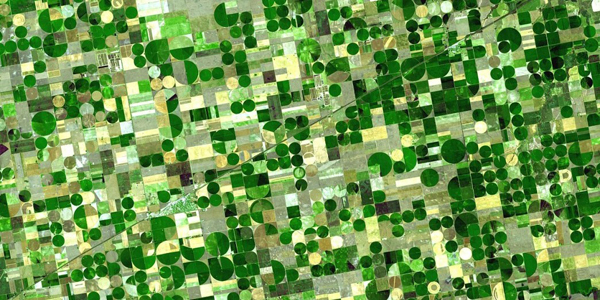
Urbana, IL - Continuing its legacy of leadership in the area of sustainable agriculture, the College of Agricultural, Consumer and Environmental Sciences (ACES) at the University of Illinois is pleased to announce a generous gift of aerial imagery from Aerial Agronomy, Inc. Two multispectral agricultural data sets, valued at $1.5 million, will be used in teaching and research, including efforts towards estimating soil health and carbon flux from agricultural land in the Midwest. Aerial Agronomy provided ACES and the university multispectral images collected via aircraft during recent growing seasons across Illinois, Iowa, and Minnesota, for a total of 17.5 million acres. The images paint a picture of crop performance, as well as soil health and carbon content, across the region throughout the growing season. "As a retired research engineer from the University of Illinois, I find it particularly rewarding to work closely with and support ag research programs at Illinois," says Bob Coverdill, president of Aerial Agronomy, Inc. "Our unique ability to provide aerial services and engineering support, literally in the backyard of the university, makes this a natural partnership. We look forward to continuing our relationship with faculty and students in the College of ACES." According to Coverdill, Aerial Agronomy, Inc. is a leading provider of agricultural aerial imagery. It provides full service to farmers and growers through subscription-based imagery and software tools to guide decision-making from preplant to harvest. Its software platform, AirScout, is a robust, easy to use, strategic tool that helps farmers reduce input costs, make better in-season decisions, and increase their profitability. Aerial Agronomy, Inc. has headquarters in Champaign County, and serves growers throughout the Midwest via its own fleet of manned airplanes and sensor systems. One of the beneficiaries of the donated images is Kaiyu Guan, assistant professor in the Department of Natural Resources and Environmental Sciences (NRES) at Illinois, Blue Waters professor with the National Center for Supercomputing Applications, and affiliate of the Center for Digital Agriculture. "The donated images from Aerial Agronomy, Inc. are very valuable and will enable a wide range of research in agricultural productivity and sustainability, as well as education for our students," he says. Guan's work leverages remote-sensing data, such as the multispectral images from Aerial Agronomy, along with on-the-ground field work, supercomputers, and advanced statistical techniques to address how climate and human practices affect crop productivity and ecosystem functioning. "Some of my lab's work in remote sensing can really benefit from the richer data collected by Aerial Agronomy in real-world production environments. I also plan to use these images in undergraduate and graduate classes," Guan says. "We greatly appreciate the generosity from Bob's team. We hope these data can strengthen the university's land-grant mission and ultimately bring benefits to Illinois farmers." Tweet |
|
|
|
|
|
|
|
|
|||||||||||||